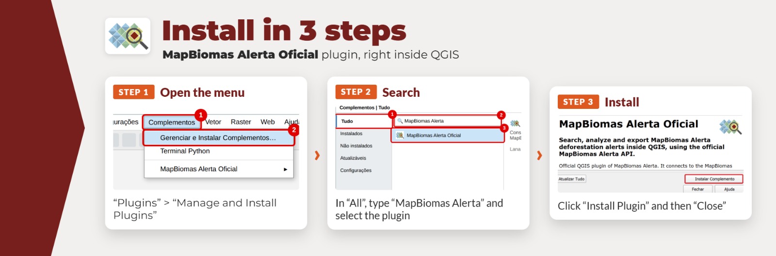

The MapBiomas Alerta plugin for QGIS allows you to access, visualize, and analyze validated deforestation alerts directly within your QGIS project, in a practical and integrated manner.
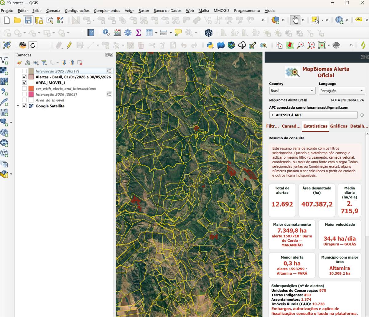
The MapBiomas Alerta QGIS plugin is an extension that facilitates access to deforestation alert data—validated by MapBiomas Alerta—directly within the QGIS environment.
With it, you can consult, filter, and view alerts at different territorial levels, as well as download vector data for detailed spatial analysis.

Search for alerts by time period, location, and territorial segments.

View alerts directly in QGIS with automatic symbology.

Download the vector data for analysis and cross-referencing in your project.

Follow new alerts as the platform is updated.
Watch the video below and learn how to install and use the MapBiomas Alerta plugin in QGIS, step by step.
Download the complete PDF tutorial, featuring a detailed, step-by-step guide on how to install and use the plugin.